There's one question we hear almost every day, usually before the visitor has even finished lifting their suitcase out of the hire car: "so where's the volcano?". Since September 2021, the Tajogaite has worked its way onto the list of reasons people decide to come to La Palma, and honestly, it's easy to see why. There aren't many places in the world where you can walk beside a landscape that, geologically speaking, is still fresh out of the oven.
This article is part of our Full guide: what to do in La Palma, where you'll find all the activities, routes and tips to plan your trip to the island.
We're going to tell you what we usually tell our groups out on the ground: where the name comes from, what happened during those 85 days, why La Palma takes it into its head to make new volcanoes and, while we're at it, how to plan your visit.
🛶 Guided kayak on the west coast of La Palma: our tour from Porís de Candelaria to the Cueva Bonita sea cave — photos included, from age 5; every participant must be able to swim. From €45. Check current dates before planning your visit.
Book your kayak tour →Tajogaite, Cumbre Vieja, Cabeza de Vaca… so which is it?
Throughout the eruption, news bulletins around half the world repeated "the Cumbre Vieja volcano" over and over. It stuck in the collective memory, but the name isn't really quite right. Cumbre Vieja is the entire volcanic ridge that begins south of Pico Bejenado and runs down to the southern tip of the island, continuing several kilometres under the sea. It is, in fact, the ground you walk on along the famous Ruta de los Volcanes (the Volcano Route), made up of dozens of cones from far older eruptions.
The one that was born in 2021 has its own name, and a lovely one at that: Tajogaite, an indigenous word that translates as "cracked mountain". Rarely does a name describe so literally what happened: the earth split open along a first fissure and everything poured out of it. It's also known as Cabeza de Vaca, after the area where it sits. Tajogaite formed during the 2021 eruption, which created new land on La Palma.
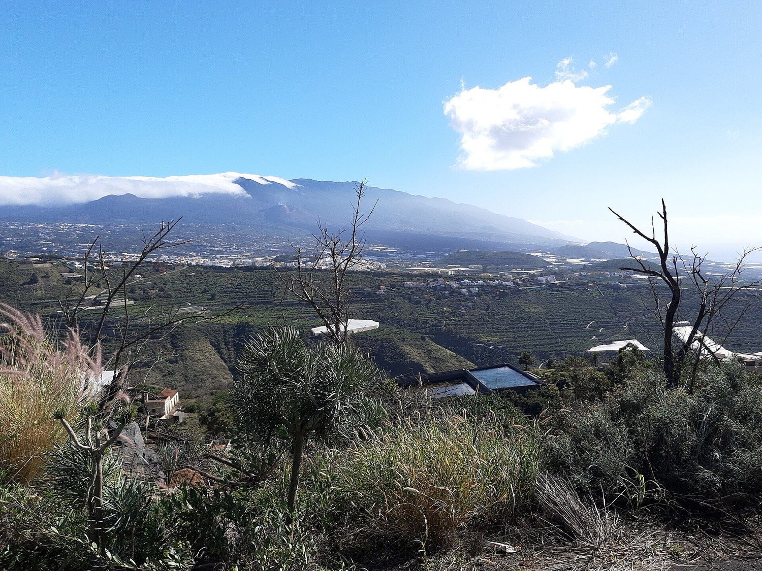
85 days that split the island into a before and an after
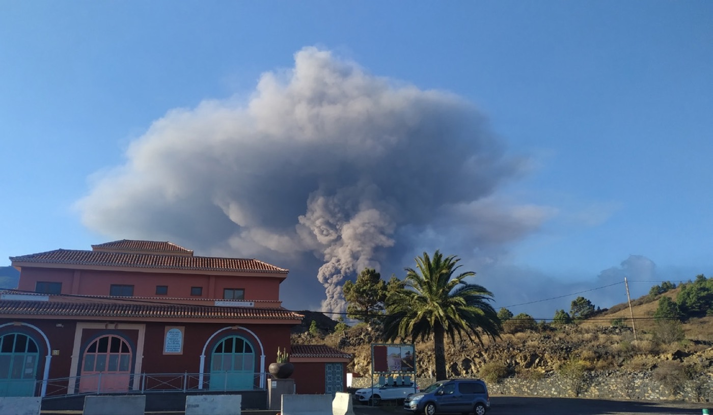
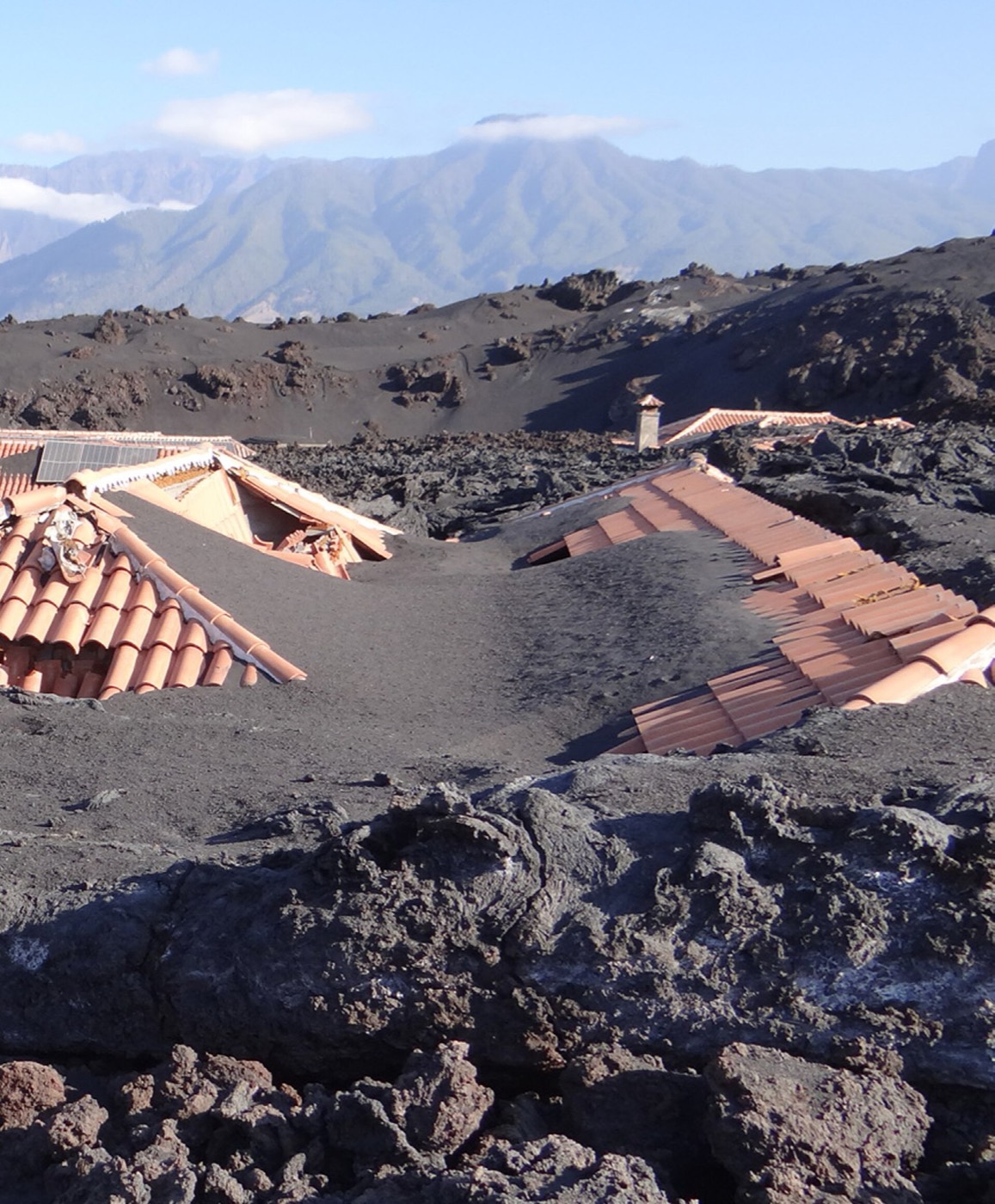
Let's get to the numbers, though no number fully explains what it feels like to see it up close. The volcano was born in El Paso, on the western slope of Cumbre Vieja, and reached a height of around 200 metres. Its eruption was the longest ever recorded in the history of La Palma: 85 days and 8 hours without stopping. The lava covered more than 1,200 hectares, forced some 7,000 people to evacuate and buried close to 3,000 buildings under ash and rock. More than 1,600 homes were swallowed up, just as many left unusable, and some 80 kilometres of road simply vanished. Almost 400 hectares of banana plantations, vineyards and avocado groves were lost overnight.
What's genuinely worth highlighting is that, thanks to the technology used to follow the whole process, this eruption also became a scientific case study: it had probably never been possible to monitor one in such detail, from the very first tremor to the months of readjustment that followed.
Why does La Palma keep making volcanoes?
This is the bit we most enjoy explaining, because there's a real story behind it. For years, the accepted idea was that the Earth had originally been something like a very hot apple that, as it cooled, gradually wrinkled up, and those wrinkles were the mountains. The trouble is that this theory explained neither volcanoes nor earthquakes, still less why the continents appeared to be moving.
The person who turned it all on its head was a German meteorologist, Alfred Wegener, while observing something as un-volcanic as polar ice: as they collided, the ice sheets formed long ridges, just like the ones we see on the continents. What remained to be explained was how such vast masses of land could move horizontally. That piece was supplied by a geologist named Harry Hess: during the Second World War, his ship carried sonar to detect submarines, and at night he would leave it running to map the seabed out of pure curiosity. That's how the mid-ocean ridges were discovered, and from there came the idea that the Earth's interior stays molten, with the continents drifting over that layer at roughly the speed our fingernails grow.
Two further theories help to complete the puzzle: the hotspot theory, which explains why the eastern islands of the archipelago are far older than the western ones, and the Canary microplate theory, which explains why areas like La Gomera are practically without activity while others concentrate all the energy. La Palma has a bit of everything: shield volcanoes, broad and gently sloping; a classic stratovolcano (the Bejenado); and the fissural, monogenetic activity of the whole of Cumbre Vieja, to which the Tajogaite belongs. We tell our groups that Cumbre Vieja behaves a little like a face with acne: we know more volcanoes will appear, but not when, nor where, nor what they'll be like.
An eruption with two faces, and the moon looking on
During those 85 days, the activity changed, alternating more explosive phases with more effusive ones.
What you're walking on when you cross the lava flows
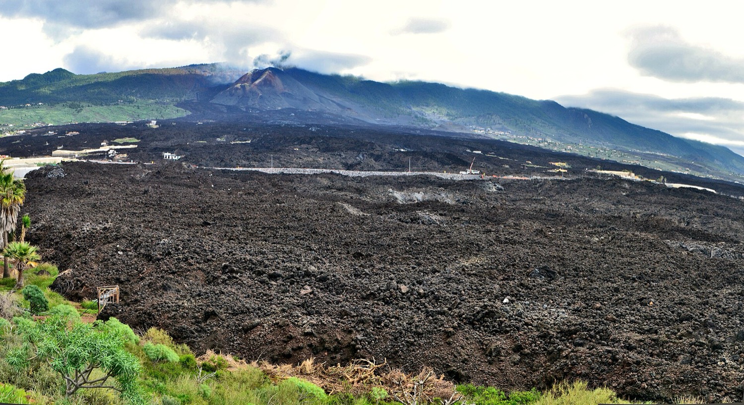
Walking beside the Tajogaite's lava flows is, without exaggeration, like leafing through an open-air volcanology manual. There are two kinds of solidified lava and, as you'd expect, in the Canaries they have their own names. Lajial (what the rest of the world knows as pahoehoe) has a smooth surface, rippled or braided like rope, the result of nimble-flowing lava beneath an already-cooled crust. Malpaís (the equivalent of Hawaiian aa) is exactly the opposite: rough, fragmented and chaotic-looking, formed when the surface cools and breaks apart under the pressure of the magma still advancing, hot, beneath it.
Alongside the flows you'll also see the different materials the volcano threw into the air during the eruption: ash, so fine it can travel for kilometres on the wind; lapilli, those small fragments that in the Canaries we call picón or rofe depending on the island; and volcanic bombs, rounded in shape and a size that takes many people by surprise. Ash, pines burnt at their base, the odd building barely poking out from under the flow… the whole scene is far more striking in person than in any photograph, we can assure you.
The island that never stops rising
La Palma is a volcanic island, and erosion and geological processes continue to reshape its landscape. The 2021 eruption clearly showed how quickly an eruption can transform the land.
So, how do you actually visit?
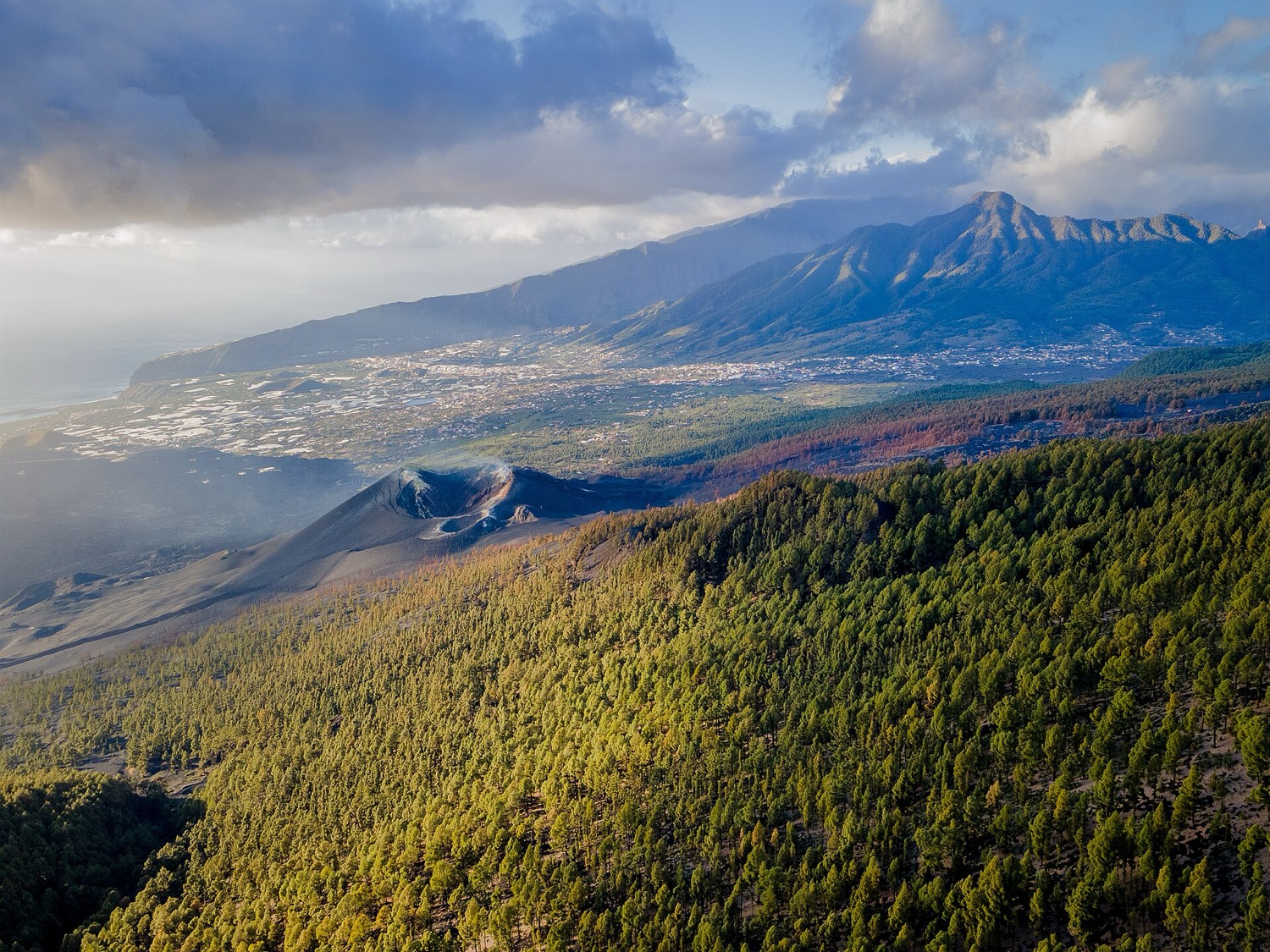
Here's the part we get asked about most. For now, close access to the cone remains regulated, and most visits are made through authorised companies, with a limited number of people per day. This may change over time —the rules have been adjusted since the end of the eruption— so it's always wise to confirm the conditions before you go. Volcanic gases are constantly monitored in the area and there are checkpoints along the route, so we're not talking about pointless red tape but about a genuine safety measure.
The usual meeting points tend to be the Refugio del Pilar, the Caldera de Taburiente Visitor Centre or the Llano de las Brujas. From there, most routes cover between 5 and 6.5 kilometres with a gentle gradient, around two to three hours, so you don't need to be an experienced hiker to do them. The route usually ends at the Mirador de Tajogaite, about 300 metres from the volcano's northern vent, with the cone and the lava flows that run down to the sea right in front of you. If you'd rather see it without walking, there are also boat trips from Puerto de Tazacorte that draw close to the new fajanas, the land created by the lava as it flowed into the ocean.
Fancy climbing up to the volcano with a guide who knows the terrain inch by inch? We work with a trusted local guide who takes you right to the very edge of the cone, safely and telling you the story out on the ground.
See the guided tour to the Tajogaite volcanoA couple of things worth knowing before you set off: wear closed walking boots, because the ash-and-lapilli terrain is uneven; bring sun protection and water, especially if you go in the hotter months; and book in advance, because daily numbers are limited and in high season places sell out easily. The activity can also change or be cancelled due to strong wind, fire risk or a decision by the Parque Natural de Cumbre Vieja, so it pays to stay flexible.
What to see near the Tajogaite volcano
A visit to the volcano pairs wonderfully with other corners of western and southern La Palma. If you devote a full day to the area, here are a few plans that fit perfectly:
- Los Llanos de Aridane and El Paso: the two municipalities surrounding the volcano, with great viewpoints, street art and the Caldera de Taburiente Visitor Centre.
- Puerto de Tazacorte and the fajanas: the new land the lava won from the sea. Boat trips leave from the harbour to see the lava delta up close.
- Ruta de los Volcanes: hiking among the older cones of Cumbre Vieja to understand the Tajogaite's "before". See our best hiking trails.
- The volcanic south: the Fuencaliente salt flats and the Teneguía volcano, in La Palma south, complete the island's geological portrait.
And if you'd rather swap lava for water, there's nothing like seeing the west coast from the sea: discover our kayak tour to Cueva Bonita.
The scar that became a destination
The Tajogaite tells you, better than any brochure, what La Palma is: a living island, still forming, that changed its landscape overnight and goes on writing its own geological history beneath our feet. Visiting it isn't just signing up for another excursion; it's understanding, with your feet on the ground, how an island is born.
And when you're done with the volcano, the best way to keep discovering the island is from the sea: our kayak trip along the west coast takes you to cliffs and caves that can only be seen from the water. Take a look too at what to do in La Palma in 3 days or 7 days.